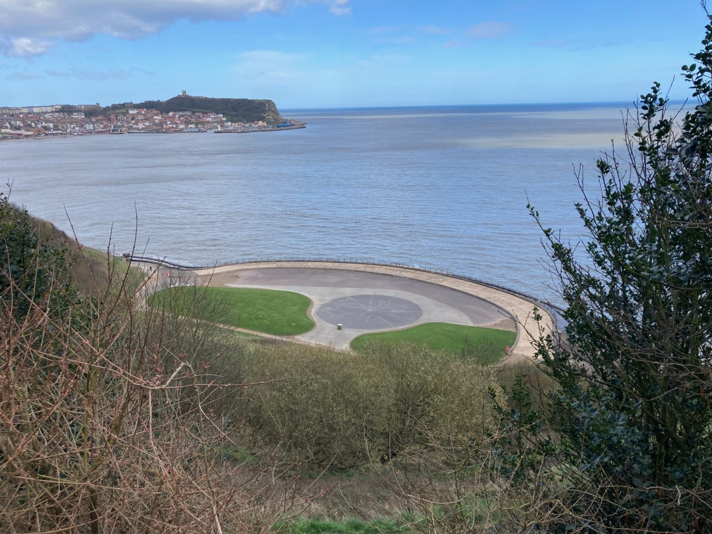
Scarborough’s Star Map
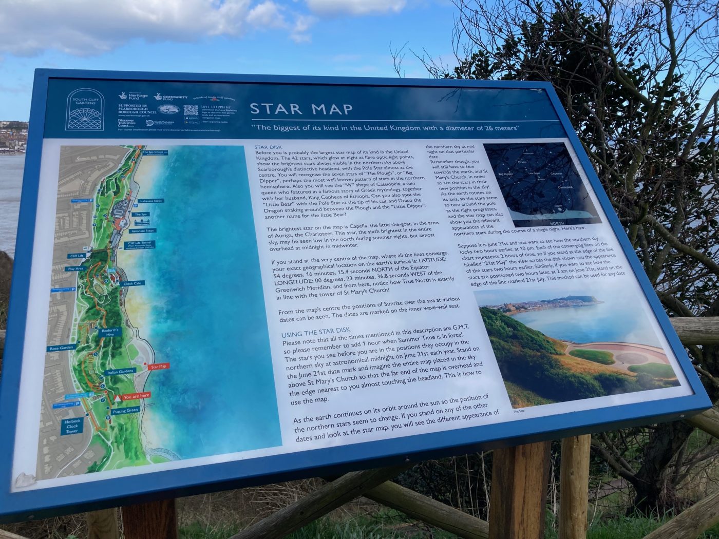
With a diameter of 26 metres, Scarborough’s Star Map, or Star Disk is the largest in the UK.
While you can see it during the daylight, it’s during the night time hours it looks its best with 42 fibre-optic terminals representing the circumpolar stars and constellations.
You can see easily identifiable constellations such as Ursa Major (otherwise known as The Plough).
There is also sunrise and sunset times on the star disk.
If you want to know your exact geographical location then if you stand in the centre of the disk, you are at a latitude of 54 degrees, 16 minutes and 13.4 seconds north of the Equator, longitude 00 degrees, 23 minutes and 36.8 seconds west of the Greenwich Meridian.
The Star Map ‘stands’ on the site of the once-famous South Bay Pool.
The pool opened in 1915 with works completing in the following year.
It was the largest in Europe at 330 feet long and 167 feet wide.
In 1934, the facility featured upgraded seating and the installation of the famous 32ft diving board.
This lead to Scarborough hosting the 1948 Olympic Diving preliminaries.
It closed in 1989 and was derelict for some time before it was filled ready for the star map we see today.
Find out more about the Star Map!
The Star Map is close to the Scarborough Spa and you can see it from close the Esplanade.
You can find out more about Scarborough history here.